

Charing Cross is the western gateway to the centre of St Helier, and until the early 19th century it was literally a gateway, with a narrow tunnel passing under the prison, which then straddled the wide road. But it had to go, partly because it was in an appalling condition, and partly because of the Lieut-Governor, General Don's road-building programme. He wanted to be sure to be able to move troops and equipment quickly around the island in times of emergency, and his guns would not pass through the tunnel under the prison.
The location of the prison gave Charing Cross its original name La Rue de la Prison. It was also known as La Pompe du Bas, because one of two town pumps, providing residents with fresh water, was located there.


To the west of Charing Cross was undeveloped sandy land, stretching down to the sea. The old town wall ran from here to the south of Broad Street, which was known as La Grande Rue, because it was the main thoroughfare to the Royal Square. The other street leading into the town from Charing Cross, King Street, barely existed in the early days of the development of St Helier. Today it is the island's main shopping street; then it was a back street, appropriately known as Rue de Derrière.
Prison
The prison was built Between 1688 and 1697. Before then all prisoners had to be held at Mont Orgueil Castle, and brought from there to town for trials at the Royal Court. It is believed that the design of the prison may have been because it was intended to represent a city gate, but it may also have been a copy of old Temple Bar in London. It was demolished in 1811.
Street layout
Charing Cross has a very unusual layout and numbering system. No 1 is the first property in Charing Cross on the southern side, following on from Broad Street.
The numbers continue in numerical sequence to No 10 at the junction with Castle Street, and then back on the opposite side of the road as far as No 15, the corner property facing east. Numbers continue around this corner in a separate section of street as far as York Street, and then back along the north side of the street as far as King Street.
Where Charing Cross ends and King Street starts has been a matter for considerable confusion over many years. Rutland House, the property on the corner with Pitt Street, appears in almanac listings as 29 Charing Cross, and in others as 78 King Street, where it is shown in the 21st century. There are numerous advertisements for businesses trading at the property giving their location as Charing Cross. The 'clock tower' building across the street, which makes the corner with Broad Street, has also been described in adverts as Charing Cross, without a number, but it has always been officially listed as 79 King Street.
Histories of individual properties
| No 1 | No 2 | No 3 | No 4 | No 5 | No 6 | No 7 | No 8 | No 9 | No 10 |
| No 11 | No 12, 12a | No 13 | No 14-15 | No 16 | No 17 | No 18 | No 19 | No 20 | No 21 |
| No 22 | No 23 | No 24 | No 25 | No 26 | No 27 | No 28 |
Picture gallery

Click on image to see larger picture

The old prison

1942

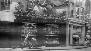
Larbalestier perfumery

Larbalestier's

Charing Cross in the 1930s

Charing Cross in the 1930s

Charing Cross in 1955 - Picture Evening Post


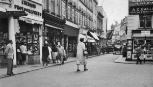
Charing Cross in the early 20th century, with King Street to the left and Broad Street to the right

Picture from about 1920 by Albert Smith showing A Quenouillere's shop on the corner with Pitt Street offering a strange combination of jewellery and bicycles

1907


1968

Possibly taken during the German Occupation

German Victory Parade on 9 August 1940

The arch erected for Queen Victoria's Diamond Jubilee in 1897

The jubilee arch from the other side

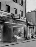
Huelin's, 2 Charing Cross

The corner of Charing Cross and Dumaresq Street

The Co-operative on the corner with Pitt Street in 1940

King George V's silver jubilee in 1935

The doorway to A Le Rossignol pharmacist

Rutland House cycle shop

1936


In the 1930s

The early 1900s


The modern granite cross at Charing Cross

1950s

1960

1960s

19 and 20 Charing Cross

16 Charing Cross

A Visite Royale passes through Charing Cross in 1908
1930s

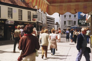
1970s

1970s


1950s

19 Charing Cross


Decorated for the Coronation in 1953


Dumaresq Street junction

1897

1900s

1942

1929

1940s

1928

During the Occupation


Businesses

Dupre and Sons, plumbers

Dupre and Sons

Johnnie Walker whisky, or alcohol-free cordials manufactured at 7 Charing Cross

Charing Cross supply stores

The Light and Heat Depot, dealers in paraffin stoves and lights

Rutland Cycle Works

P P Le Marquand, ironmonger

Larbalestier eau-de-cologne


Letto

1950

1950

1852
1852

1905

1920s

1853 advert

1859

1855
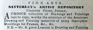
1857

Letto, 1940

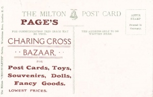
Page's Charing Cross Bazaar was the business of Mr F R Page, at No 6, according to an almanac entry in 1910

1855

1862 advert

1925

1925

1948

1948

1948

1948

1948

1948

1948

1955

1955
1853
1881 advert

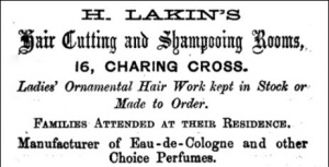
1873 advert
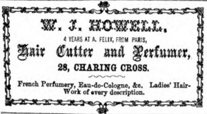
1873 advert. W J Howell seems to have learnt his trade with French hairdresser Felix Audoin, who was in business at this time in Queen Street

1927 advert

1927

1887 advert from L'Almanach de la Gazette de Jersey

1866 Nouvelle Chronique advert showing prices of Barkas fuels

1903

1908

1900

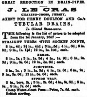
1857

Le Monnier grocer, tobacconist, wines and spirits
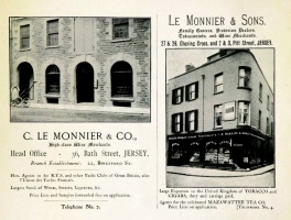
A 1899 advert for the business

1903

1897

1905

1953

1953

1953

1889


